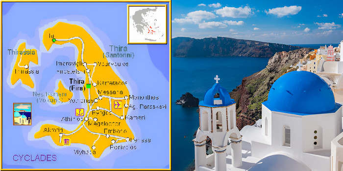
Santorini is one of the most beautiful and famous islands in the world. Located in the southern part of the Aegean Sea in Greece, it is known for its stunning views, whitewashed houses, blue-domed churches, and unforgettable sunsets. This small island welcomes visitors from all over the world who come to experience its magic.
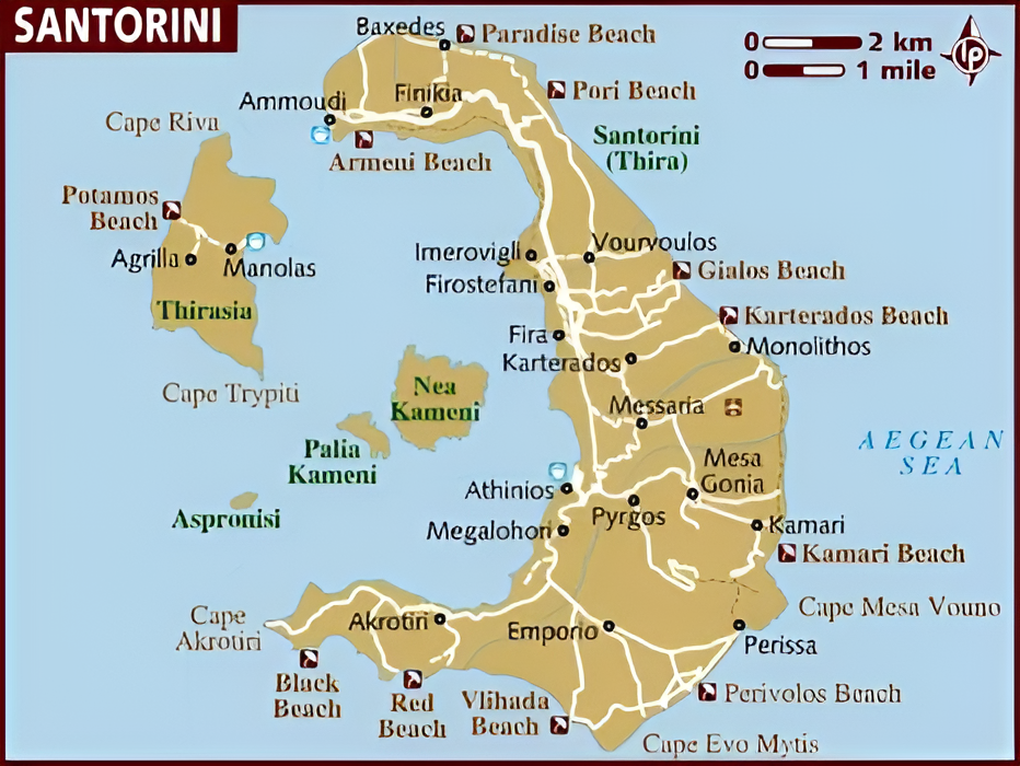
If you are planning a trip to Santorini, having a good Santorini map is very important. It will help you explore the island, find the best places to visit, and make the most of your time. This page will give you helpful tips, important information, and a basic guide to Santorini, using simple English that everyone can understand.
Where Is Santorini?
Santorini is part of the Cyclades islands in Greece. It is a volcanic island shaped like a half-moon. The island was formed after a huge volcanic eruption about 3,600 years ago. This eruption created the famous caldera, a large crater surrounded by steep cliffs. Today, Santorini is made up of several villages built around this caldera.
The island is small, about 18 km long and 12 km wide. Even though it is small, there are many things to see and do. A Santorini map will show you how close the villages and beaches are, and help you plan your travel around the island.
The Most Famous Villages in Santorini
Fira (or Thira) is the capital of Santorini. It is full of shops, cafes, restaurants, and museums. Fira has great views of the caldera and is a central point on any Santorini map.
Oia is the most famous village on the island. It is well known for its amazing sunsets and beautiful white houses with blue roofs. Oia is located in the north of Santorini and is a must-see for all visitors.
Imerovigli, sometimes called the “Balcony of the Aegean,” is peaceful and romantic. It has high cliffs and incredible views, making it a popular place for honeymooners.
Pyrgos is a traditional village in the center of the island. It has narrow streets, a castle, and fewer tourists than Oia or Fira. It’s a great place to experience the local lifestyle.
Kamari and Perissa are beachside villages on the east and south sides of the island. They are perfect for swimming, sunbathing, and relaxing by the sea.
Top Things to Do in Santorini
Watch the sunset in Oia.
Swim at the Red Beach and Black Beach.
Visit the ancient ruins of Akrotiri.
Take a boat tour of the volcano and hot springs.
Enjoy wine tasting at a local winery.
Hike from Fira to Oia (about 2–3 hours).
These are the most popular activities that visitors search for online. With a good Santorini map, you can easily find these locations and make your own travel plan.
A Santorini map will help you find the best beaches. It will help you discover traditional villages. You can also plan your hiking routes, like the popular Fira to Oia trail. A map helps you locate restaurants and wineries, understand the public bus system, and choose the best spots for sunset views.
Most hotels and tourist shops give free paper maps, but you can also use digital maps on your phone, like Google Maps. If you plan to rent a car or ATV, a map is very helpful for navigating the small island roads.
Tips for First-Time Visitors
Best time to visit: May to October. July and August are the busiest months.
Currency: Euro (€)
Language: Greek, but most people in tourism speak English
Safety: Santorini is very safe for tourists
Weather: Hot and dry in summer, mild in spring and autumn
Santorini is not just a place to visit—it is an experience to remember. Whether you are traveling alone, as a couple, or with family, Santorini offers something special for everyone. A reliable Santorini map will help you move around with ease and make sure you don’t miss anything important.
Before your trip, download a Santorini map, check the top attractions, and plan ahead. That way, you will spend less time getting lost and more time enjoying this magical Greek island. Plan smart. Explore freely. Discover the beauty of Santorini.